Low-Density Urbanism Impact Calculator
This tool estimates the potential impact of implementing low-density urbanism principles in a city. Enter your current city metrics below to see projected improvements.
Current City Metrics
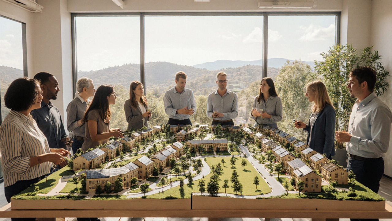
Imagine a city that feels spacious, yet buzzes with activity, where parks sit next to cafes and commuters glide on bike lanes without getting stuck in endless traffic. That balance isn’t a day‑dream; it’s the promise of low density urbanism when planners use it correctly.
Low density urbanism is a planning approach that deliberately limits building density in order to protect open space while steering growth toward pre‑defined corridors and hubs. It sounds counter‑intuitive in an age where “bigger is better” dominates headlines, but the model directly tackles the root causes of urban sprawl and offers a pathway to truly sustainable growth.
Why Urban Sprawl Is a Growing Crisis
Urban sprawl refers to the uncontrolled expansion of a city’s built‑up area into surrounding countryside, typically characterized by low‑density residential zones, heavy car reliance, and fragmented services. In the UK, the Office for National Statistics reported that between 2001 and 2021, mixed‑use development share fell from 35% to 22%, while low‑density detached housing rose by 18%.
- Land consumption per capita climbs, eating up valuable agricultural and natural habitats.
- Infrastructure costs skyrocket because utilities, roads, and public transport must stretch over larger areas.
- Carbon emissions increase as residents travel longer distances by car.
- Social cohesion erodes when neighborhoods are isolated and lack walkable amenities.
Core Principles of Low Density Urbanism
The model rests on a handful of clear rules that keep development orderly while preserving the feel of spaciousness.
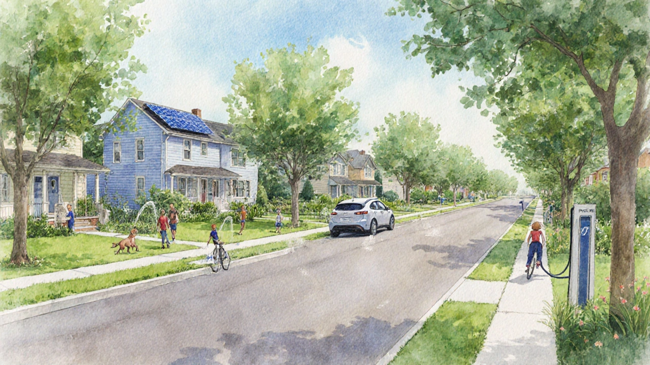
- Defined Growth Nodes: Concentrate higher‑density housing and commercial activity around transit hubs and existing town centres.
- Green Buffers: Mandate minimum green space between new clusters to maintain ecological corridors.
- Mixed‑Use Zoning: Allow residential, office, and retail uses to coexist within each node, reducing the need for long commutes.
- Transit‑Oriented Design: Prioritise walking, cycling, and frequent public transport over parking spaces.
- Smart Growth Policies: Use incentives and regulations to steer developers toward the growth nodes.
Low Density Urbanism vs. Compact City Model
Many people lump low density urbanism together with the “compact city” approach, but the two have distinct trade‑offs. The compact city focuses on high density throughout, often sacrificing green space. Low density urbanism, by contrast, keeps density low *within* each node while preserving open land between them.
| Attribute | Low Density Urbanism | Compact City |
|---|---|---|
| Average Density (people/ha) | 30‑50 | 80‑120 |
| Land Consumption per Capita (m²) | 250 | 120 |
| Infrastructure Cost (€ per capita) | 1,200 | 2,400 |
| Mobility Index (walk‑bike‑transit score) | 78 | 85 |
| Green Space per Capita (m²) | 35 | 12 |
Numbers come from a 2023 European Urban Planning Review, which analysed 42 metropolitan areas. While the compact city shines on mobility, low density urbanism beats it on green space and long‑term infrastructure budgets.
How Low Density Urbanism Supports Sustainable Growth
Sustainable growth isn’t just about limiting carbon; it’s about creating livable, resilient communities. Here’s how the model delivers.
- Green infrastructure - such as parks, wetlands, and tree‑lined corridors - remains intact, improving air quality and biodiversity.
- By clustering development around Transit‑oriented development, public transport usage climbs, cutting per‑capita emissions by up to 25% according to Transport for London data.
- Mixed‑use neighborhoods encourage walking and cycling, raising the Walkability score to levels comparable with dense city centres.
- Lower density reduces the heat‑island effect, a growing concern for UK cities as summer temperatures hit new highs.
- Strategic zoning policies keep land values stable, preventing speculative spikes that often drive unaffordable housing.
Real‑World Examples that Show It Works
Several cities have already adopted low density urbanism principles with measurable success.
- Portland, Oregon (USA): The city’s Urban Growth Boundary limits expansion, preserving over 650,000 acres of farmland. Since its adoption in 1979, per‑capita energy use has fallen 15% compared with neighboring metros.
- Helsinki, Finland: By zoning new suburbs around light‑rail “spokes,” the city keeps average commute times under 30 minutes while maintaining a 30‑plus per cent green‑space share.
- Milton Keynes, UK: The original 1967 plan incorporated “grid squares” with low‑density housing, ample green corridors, and a strong cycle network. Recent sustainability audits rank it among the top UK towns for life‑quality scores.
Each case demonstrates that a disciplined, low‑density approach can coexist with vibrant economies and livable neighborhoods.
Implementing Low Density Urbanism in Manchester
Living in Manchester, I see both the challenges and the opportunities. Here’s a practical roadmap for the city.
- Identify Growth Nodes: Leverage existing Metrolink stations-such as East Didsbury and MediaCityUK-as anchors for higher‑density mixed‑use districts.
- Revise Zoning: Introduce “low‑density mixed‑use” zones that cap building heights at 4‑5 storeys but allow ground‑floor retail and community facilities.
- Protect Green Belts: Strengthen the Greater Manchester Green Belt by adding mandatory buffer zones of at least 100m between new developments.
- Boost Cycling Infrastructure: Expand the Cycle Superhighways to connect growth nodes, aiming for a 20% modal shift by 2030.
- Incentivise Developers: Offer tax reliefs for projects that meet the low‑density mixed‑use criteria and embed affordable housing units.
City planners who follow this checklist can curb sprawl, keep housing affordable, and maintain Manchester’s famous “Northern Powerhouse” vibe without sacrificing green space.
Common Pitfalls and How to Avoid Them
Even the best‑intentioned plans can stumble. Here are the traps most planners fall into and quick fixes.
- Over‑centralising Services: If only the core node gets schools and clinics, residents on the fringe will still rely on cars. Solution - distribute essential services proportionally across each node.
- Ignoring Community Input: Top‑down zoning often meets resistance. Solution - hold participatory workshops early to co‑design public spaces.
- Under‑funding Public Transport: A growth node without reliable transit will revert to car dependence. Solution - lock in funding for frequent, low‑fare services before development permits are issued.
- Mis‑labeling “Low Density”: Some developers mistake “low density” for “sprawling suburbs.” Solution - enforce density caps and land‑use mix percentages through strict planning conditions.
TL;DR
- Low density urbanism limits building density while focusing growth around defined hubs.
- It directly counters urban sprawl’s land‑use, cost, and emission problems.
- Key tools: growth nodes, green buffers, mixed‑use zoning, and transit‑oriented design.
- Compared with compact cities, it offers more green space and lower infrastructure costs.
- Manchester can adopt a five‑step roadmap to reap these benefits.
Next Steps for Planners, Developers, and Citizens
Whether you’re a city official, a property developer, or a resident who cares about the neighborhood, there are concrete actions you can take today.
- Planners: Draft a draft zoning amendment that defines low‑density mixed‑use districts and circulate it for feedback.
- Developers: Run a feasibility study on building mid‑rise mixed‑use blocks around the nearest Metrolink station.
- Citizens: Join a local “Greenspace Watch” group to monitor new proposals and ensure they respect green buffers.
By aligning goals across these groups, the city can steer growth toward a sustainable, pleasant future.

Frequently Asked Questions
Is low density urbanism the same as suburban sprawl?
No. Suburban sprawl lacks coordinated growth nodes and often spreads without adequate services. Low density urbanism deliberately clusters development, preserves green buffers, and integrates transit, making it a controlled alternative.
Can low density urbanism work in high‑growth cities?
Yes. By designating multiple growth nodes and linking them with high‑frequency public transport, even fast‑growing metros can keep expansion in check while providing affordable housing.
What’s the ideal size for a growth node?
Studies suggest a radius of 800‑1,200m around a transit hub balances walkability with sufficient land for mixed‑use development. The exact size depends on local density targets and existing infrastructure.
How does low density urbanism affect housing affordability?
By concentrating housing near transit and limiting speculative land consumption, the model can keep land prices stable, freeing up resources for affordable‑housing quotas within each node.
What role do green spaces play in this approach?
Green buffers act as ecological corridors, improve air quality, and provide recreational areas that raise quality of life. They also help mitigate flood risk and urban heat islands.


Holly Hayes
September 29, 2025 AT 15:40Honestly, anyone who still champions sprawl clearly hasn't read a single piece of decent urban theoree.
Matthew Shapiro
October 4, 2025 AT 10:20Low‑density urbanism can feel like a paradox in an era obsessed with density, yet the data you shared makes a compelling case.
By concentrating growth around transit nodes, we preserve green corridors while still keeping commute times reasonable.
The cost savings on infrastructure are especially striking-halving per‑capita expenses could free up budget for affordable housing.
I also appreciate the emphasis on mixed‑use zoning; it bridges the gap between work and life.
If more cities adopted these principles, we might finally see a balance between sprawl and over‑crowding.
Julia Phillips
October 9, 2025 AT 05:00When I first read about low‑density urbanism, a wave of hope surged through my veins like an epic symphony rising from a silent plain.
The notion that we can tame the relentless beast of sprawl without sacrificing the soul of a city feels almost mythic.
Imagine strolling through a boulevard flanked by towering oaks, the sunlight dappled on a mosaic of cafés and community gardens.
Below, a tram glides silently, its passengers laughing, unburdened by the snarls of traffic that choke so many metropolises.
This vision is not a whimsical fantasy; it is anchored in hard numbers, as your tables starkly reveal.
Reducing land consumption by half translates to thousands of hectares of reclaimed habitat, a priceless gift to biodiversity.
Halving infrastructure costs per capita means municipalities can redirect funds to schools, health clinics, and cultural institutions.
The projected 30‑percent drop in carbon emissions could be the decisive factor in meeting climate targets by 2035.
Moreover, the generous green spaces per person foster mental health, encouraging residents to breathe, play, and connect.
Cities like Portland and Helsinki have already lit the path, proving that disciplined zoning can coexist with economic vitality.
Their successes whisper a promise: that policy, when guided by clear growth nodes, can rewrite the narrative of endless expansion.
Yet the road ahead is fraught with political inertia, vested interests, and the seductive allure of quick‑profit developments.
We must therefore marshal community voices, champion transparent planning, and hold developers accountable.
Only through collective vigilance can the fragile equilibrium between openness and density be preserved.
In the end, low‑density urbanism may become the quiet hero that ensures our children inherit cities alive with nature, opportunity, and resilience.
Richa Punyani
October 13, 2025 AT 23:40Your eloquent portrayal captures both the aspiration and the practical metrics beautifully.
The emphasis on green buffers aligns with contemporary ecological planning, and I commend the rigorous presentation of cost savings.
By framing the debate in terms of both environmental stewardship and fiscal responsibility, you make a compelling case for policymakers.
I look forward to seeing further case studies that operationalize these principles in diverse urban contexts.
Bhupendra Darji
October 18, 2025 AT 18:20Great points on mixed‑use zoning, Matthew.
The cost analysis you highlighted resonates with many municipal budgets I've worked with.
Perhaps we could also explore phased implementation to mitigate disruption during the transition.
Robert Keter
October 23, 2025 AT 13:00Low‑density urbanism, as you so passionately describe, reads like a manifesto for a new urban renaissance.
The intertwining of transit‑oriented design with generous green corridors evokes a vision of cities breathing in unison with their inhabitants.
I am struck by the stark contrast you draw between the compact city’s suffocating density and the spacious elegance of thoughtfully spaced growth nodes.
Your data on infrastructure cost reductions could serve as a rallying cry for fiscally strained councils.
Moreover, the cultural shift toward walkable, bike‑friendly streets promises to rekindle community bonds that have long eroded under car‑centric planning.
The narrative you craft does not merely inform-it inspires action across the planning spectrum.
If more practitioners internalized this philosophy, the urban landscape could transform from a maze of concrete into a tapestry of livable, sustainable neighborhoods.
Rory Martin
October 28, 2025 AT 06:40While your enthusiasm is admirable, one must consider the hidden agendas behind the promotion of low‑density models.
Some influential real‑estate conglomerates profit from the very green buffers you praise, subtly steering policy to increase land value under the guise of sustainability.
This covert influence often manifests in zoning loopholes that dilute the intended density caps.
Therefore, vigilant oversight is essential to ensure the true public good remains the priority.
Maddie Wagner
November 2, 2025 AT 01:20Low‑density urbanism offers a powerful antidote to the relentless march of sprawl, and its potential to reshape our neighborhoods cannot be overstated.
By anchoring development around transit hubs, we not only cut emissions but also foster vibrant, walkable communities where daily needs are within arm's reach.
The integration of green buffers ensures that residents enjoy fresh air, biodiversity, and a sense of openness that dense megacities often lack.
Moreover, the cost savings on infrastructure can be redirected toward affordable housing, education, and cultural amenities, creating a more equitable urban fabric.
Implementing these principles requires collaborative planning, community engagement, and a steadfast commitment to long‑term sustainability.
Boston Farm to School
November 6, 2025 AT 20:00Totally agree maddie the vibe of mixing transit with green space is 🔥
city planners need to see the data and just act fast
Emily Collier
November 11, 2025 AT 14:40The philosophical underpinnings of low‑density urbanism resonate deeply with the idea that a city should nurture both the body and the spirit.
When we preserve ample green space, we honor humanity's intrinsic connection to nature, fostering mental well‑being and civic pride.
Simultaneously, concentrating growth nodes amplifies efficiency, allowing resources to be allocated where they matter most.
This balanced approach mirrors the ancient concept of the “golden mean,” achieving harmony between abundance and restraint.
Optimism about its adoption grows as more municipalities recognize the long‑term benefits for climate resilience and quality of life.
Catherine Zeigler
November 16, 2025 AT 09:20Your reflection beautifully weaves the timeless pursuit of balance with modern urban challenges.
By framing green space as a catalyst for mental health, you highlight an often‑overlooked dimension of sustainability.
The analogy to the “golden mean” provides an elegant philosophical lens that can inspire both policymakers and citizens.
It also suggests that the path forward is not about extremes but about thoughtful moderation.
As we continue these conversations, we can collectively shape cities that honor our inner needs while meeting external pressures.
henry leathem
November 21, 2025 AT 04:00The proposed low‑density framework suffers from a fundamental misalignment with growth velocity metrics; in high‑demand corridors, the imposed caps will likely precipitate a supply‑side shock, inflating real estate premiums and destabilizing market equilibrium.
Without a dynamic elasticity model to calibrate node capacity, the scheme risks creating bottlenecks that undermine its own cost‑efficiency assertions.
jeff lamore
November 25, 2025 AT 22:40I appreciate the detailed analysis and will keep an eye on how these proposals evolve.
It's important to maintain an open dialogue as we consider next steps.
Kris cree9
November 30, 2025 AT 17:20Honestly this whole low‑density hype feels like another buzzword trend, nothing more than a lazy re‑packaging of old garden‑suburb ideas.
Paula Hines
December 5, 2025 AT 12:00While your skepticism echoes a common cynicism, dismissing low‑density urbanism outright neglects the empirical evidence that strategic density modulation can indeed reconcile ecological stewardship with socioeconomic vitality.
John Babko
December 10, 2025 AT 06:40Low‑density urbanism, in my view, represents a critical, necessary, and timely shift, one that counters unchecked sprawl, preserves essential green corridors, and fosters sustainable, community‑centric development, which we must all support, agree?
Roger Perez
December 15, 2025 AT 01:20Fascinating concepts! 🌱🚊 I’m curious about how different cities adapt the growth‑node model to their unique cultural contexts. 🤔
michael santoso
December 19, 2025 AT 20:00The notion that every municipality can simply transplant a standardized growth‑node template ignores the complex socioeconomic stratifications that underlie urban form, rendering such blanket applications analytically unsound.
M2lifestyle Prem nagar
December 24, 2025 AT 14:40Low‑density planning, when executed well, truly transforms livability.